
Public questionnaire response
Transportation
My responses to the River City Cycle Club
Read my complete Q&AAn idea to explore · illustrated concept
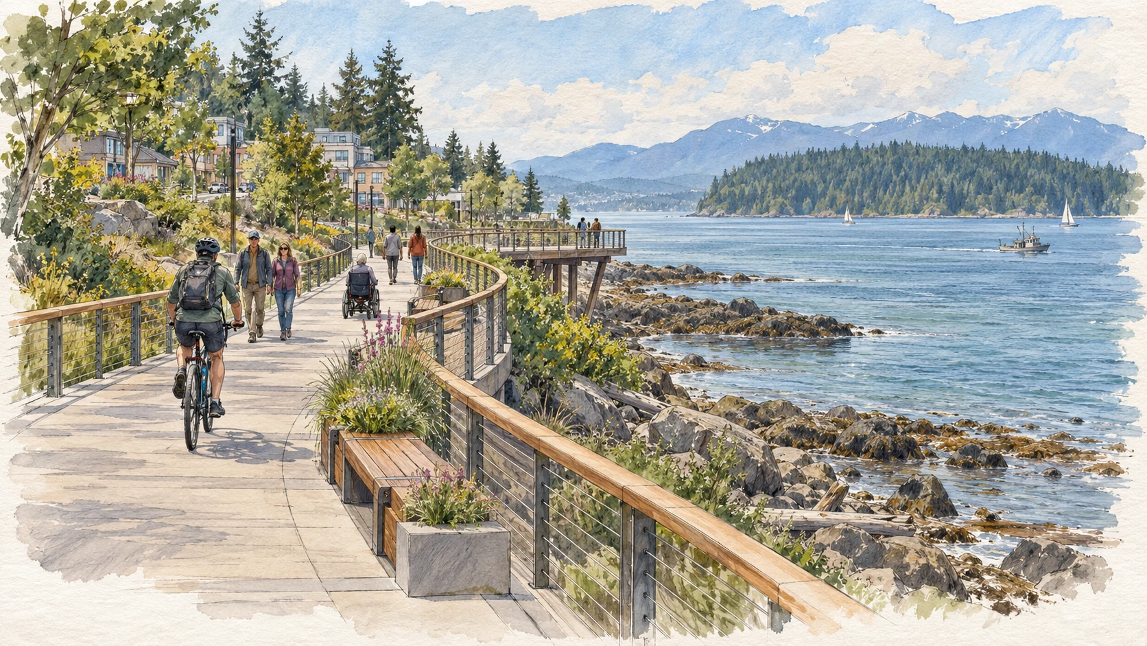
The Shoreline Walk
Hidden Harbour → Maritime Heritage Centre → downtown
Location context: the Hidden Harbour parks are south of the Maritime Heritage Centre. Seagull Walkway is farther north. The map identifies these areas without drawing a proposed route.
Out and about

My complete questionnaire response
The three questions and my complete answers are reproduced below, word for word.
A place unfamiliar? Hover over a marked paragraph, or tap its map button. Maps and The Shoreline Walk illustration are added context, not part of the original response.
1. What is your position on the ERT remaining an exclusively pedestrian and cycling route?
I support the ERT remaining a route for pedestrians and cyclists. But because it is also a legal road allowance, I think we need to plan now for what Campbell River may need 20, 30 or 50 years from now.
That is important because development is already happening along the ERT. Without clear guidelines for properties beside the corridor, buildings can be built very close to the property line. Once development occurs, it is very difficult to get that space back.
We should have guidelines for setbacks, landscaping and buffers, privacy, access points, crossings and how new development relates to the trail. Otherwise, we could slowly end up with a narrow, fenced-in corridor between developments instead of the attractive, safe green transportation route we want. The recently developed connection just south of Evergreen is a good example of my concern. It may meet current requirements, but it is not the kind of interface I would want if our goal is a welcoming, bike-friendly corridor.
We also need to think about changing transportation. E-bikes are becoming faster and more powerful, creating greater differences in speed between pedestrians, conventional cyclists and electric-assist bikes. Over the coming decades, electrification, autonomous transportation and technologies we cannot yet predict will create new opportunities and conflicts. A wide, well-planned corridor gives future councils options, including separating different users if that becomes necessary.
I also think we should consider whether parts of the corridor could provide controlled emergency access in exceptional circumstances such as a major fire, earthquake or other disaster. That is very different from opening the ERT to regular vehicle traffic. It simply makes sense not to eliminate an emergency option that a future community may need.
Most importantly, the ERT needs to be planned as part of a larger network. We need safe access points, crossings and connections from growing neighbourhoods, including opportunities such as connecting McPhedran behind Carihi toward Evergreen, improving connections to the ERT and 8th Avenue, and developing other parallel routes.
For me, preserving the ERT for active transportation and doing this long-term planning go together. If we want it to remain a good walking and cycling corridor for generations, we need to protect the space and plan its edges now.
2. Currently there is no safe cycling access to the downtown area from either the South or the North. Do you see this as a problem? If so, how might it be solved?
Yes. I see this as a significant gap in our network, and it is something I spent considerable time examining during the Master Transportation Plan process.
I was particularly interested in “desire lines” — not simply where a map says a route should go, but where people are actually likely to walk and cycle given our terrain, neighbourhoods and existing connections. I went out into the community looking at those connections and posted Instagram videos during the transportation planning process, including looking specifically at connectivity to Highway 19A through areas such as Pinecrest and 9th Avenue.
I do not think the answer is automatically to put bike lanes on arterial roads. Where practical, particularly coming from South Campbell River toward downtown, I favour cycling routes on parallel, lower-traffic streets. A well-designed 30 km/h cycling corridor can be safer, quieter and more comfortable than riding beside high volumes of faster traffic, with frequent driveways, intersections and turning movements.
We also need to design for Campbell River’s actual geography. We are not a flat city. A route can look perfectly logical on a consultant’s map but make little sense when you consider the hills and the route people will actually choose.
Rockland is a good example. Rather than assuming cyclists will climb Rockland, cross Alder, descend again and negotiate the switchback into the Highway 19A roundabout, where there is very little room to safely accommodate bicycles, I would look at the routes people are actually likely to use.
There is considerable space from Timberline to create a multi-use connection, existing multi-use infrastructure on Dogwood, and an existing cycling route near Willow Point Park. Those could connect through quieter residential streets in the Cottonwood area, down Simms and ultimately to Highway 19A.
The same thinking needs to extend north. I want us to look for a practical, relatively gentle active-transportation connection toward Painter-Barclay rather than assuming Highway 19 itself is the answer. Cycling beside high-speed traffic and heavy trucks is not going to be comfortable or attractive to most people.
I have asked staff to consider whether we can get at least as far as McDonald Road using alternative roads and potential routes around the Norm Wood Environmental Centre and solid-waste facilities. From there, we should look for logical, relatively gentle connections into Painter-Barclay and toward the existing trail and cycling systems around Baikie Island and the north end.
Highway 28 presents a similar opportunity. In discussions with BC Hydro concerning the John Hart seismic work, I have raised whether the penstock corridor could eventually be repurposed as a multi-use pathway rather than simply being reforested when that infrastructure is no longer required.
That could provide a much more comfortable alternative to cycling along Highway 28 and potentially create a connection toward Elk Falls. From there, I want us to examine City-owned lands, including the equestrian and cemetery areas, to see whether we can create a gentle, logical pathway connection into existing trail systems and ultimately toward McIvor Lake.
Those are the kinds of connections I want transportation planning to investigate: not simply the shortest line between two places, but the desire lines people will actually use, taking account of grades, traffic, safety, comfort and opportunities created by existing corridors and public lands.
I also want to see the level section of the Seawalk brought properly into downtown toward the Maritime Heritage Centre and examine how we eventually connect it toward the Seagull Walkway. There is an opportunity to be creative with that waterfront connection, perhaps as a linear greenway, while making sure pedestrians and cyclists can both use it safely.
I know the pedestrian-cyclist conflict there personally. I work nearby and regularly walk that relatively wide sidewalk, and I have had cyclists pass uncomfortably close. When our infrastructure puts pedestrians and cyclists into conflict, we should look at the design rather than blame either group.
I have also raised the possibility of allowing limited bicycle use on the sidewalk on the difficult uphill section from Hidden Harbour toward 1st Avenue, subject to what the City can legally regulate. One option worth examining would distinguish slower, pedal-powered uphill cycling from faster electric-assist travel where that speed may not be safe around pedestrians. More broadly, we need to consider appropriate use of electric assist on multi-use paths as e-bike technology develops.
My goal is not to maximize the number of kilometres of bike lanes. It is to create a connected network that people of different ages and abilities will actually feel comfortable using.
3. What actions would you support to provide safe cycling and walking access for children to all Campbell River schools?
I strongly support safe walking and cycling access for children. Connecting students to schools was already an important part of Campbell River’s Master Transportation Plan, and I spent considerable time looking at whether the proposed network would actually work for students.
I also bring some professional experience to this issue. I spent a number of years practising personal injury law and dealing with traffic conflicts and injuries. That gave me a very practical appreciation of what happens when vehicles, bicycles and pedestrians come together at difficult intersections and along busy corridors.
The Dogwood corridor particularly concerns me because of the concentration of schools and young people travelling through that area. But I don’t think we should measure success simply by whether we have drawn a bike route to a school on a map. We need to ask whether students will actually use it.
During the transportation planning work, School Trustee Craig Gillis and I specifically went to Carihi and Ripple Rock Elementary to look at bicycle use and the routes students were using. On the day we visited, there were remarkably few bicycles at either the elementary school or the high school. We discussed safety issues and different ways the routes could be improved, but seeing so few students arriving by bicycle was concerning.
More recently, Timberline students made a presentation to Council about transportation. We specifically questioned them about the proposed change to the Hilchey-area cycling network and using Simms as a bikeway. Their response was essentially, “that’s the way we travel.” Simms is now part of the new bikeway.
That is exactly why we need to talk to the people who actually use these routes. Students know which hills they avoid, which crossings feel unsafe, which quieter streets they use and how they actually travel between home, school, recreation and their friends. Where people are already choosing a sensible route, our job should often be to make that route safer rather than trying to redirect them somewhere they are unlikely to go.
Safety is also not the only factor determining whether students cycle. Practical issues matter. For example, the reduction or elimination of lockers can leave students carrying computers, books, clothing and other belongings throughout the day. That can make cycling considerably less practical.
If we genuinely want more students walking and cycling, the City and School District should look at the whole journey together: where students live, what they have to carry, secure bicycle storage, the routes they naturally choose, where they have to cross major roads, and what would make parents comfortable allowing younger children to travel independently.
One concern I had with the Master Transportation Plan was that concentrating on today’s schools can also narrow our long-term planning. We need to think not only about where schools are now, but where schools and growing neighbourhoods may be 20 or 30 years from now.
That matters because significant parts of our community were not adequately addressed in that planning, including Campbellton, First Nations communities, Painter-Barclay and areas north of town. If we define active transportation mainly around getting children to today’s schools, we risk leaving major parts of the community outside the network.
I would support a broader Safe Routes approach. We should identify where students actually live and their natural desire lines; identify dangerous intersections, missing crossings and gaps in sidewalks or cycling connections; work with the School District on existing and potential future school locations; and progressively close those gaps as roads are rebuilt and development occurs.
Terrain matters too. A route may technically exist but not be practical for a child if it involves an unnecessary climb, a difficult intersection or a busy arterial when a quieter, gentler parallel route could be provided.
A safe route to school also does not begin at the school property line. It begins in the neighbourhood where the child lives. That means looking at sidewalks, trails, crossings, lighting, intersections and connections between neighbourhoods as one system.
These improvements should benefit the wider community. A safe route that allows a child to cycle independently to school should also help a senior walk comfortably to a store, a person with a disability move around their neighbourhood, a worker commute without a car and a family reach parks and recreation facilities.
So I support safe routes to every Campbell River school, but I would place that within a larger goal: creating a connected active transportation network that people will actually use, serving the neighbourhoods and schools Campbell River has today and those we will have in the future.